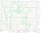
Maps showing Sifton, 24-27-20-W, Manitoba
Sifton is a Unincorporated area located in 24-27-20-W, Manitoba and has an elevation of 295 meters.
- Latitude: 51° 21' 37'' North (decimal: 51.3603000)
- Longitude: 100° 8' 33'' West (decimal: -100.1425000)
- Topography Feature Category: Unincorporated area
- Geographical Feature: Community
- Canadian Province/Territory: Manitoba
- Elevation: 295 meters
- Location: 24-27-20-W
- Atlas of Canada Locator Map: Sifton
- GPS Coordinate Locator Map: Sifton Lat/Long
Sifton NTS Map Sheets