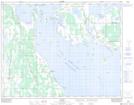
Maps showing Silver Ridge, 12-21-11-W, Manitoba
Silver Ridge is a Unincorporated area located in 12-21-11-W, Manitoba and has an elevation of 260 meters.
- Latitude: 50° 48' 6'' North (decimal: 50.8016999)
- Longitude: 98° 52' 6'' West (decimal: -98.8683000)
- Topography Feature Category: Unincorporated area
- Geographical Feature: Locality
- Canadian Province/Territory: Manitoba
- Elevation: 260 meters
- Location: 12-21-11-W
- Atlas of Canada Locator Map: Silver Ridge
- GPS Coordinate Locator Map: Silver Ridge Lat/Long