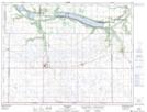
Maps showing Sinkers Slough, 2-1-13-W, Manitoba
Sinkers Slough is a Low vegetation located in 2-1-13-W, Manitoba and has an elevation of 485 meters.
- Latitude: 49° 0' 33'' North (decimal: 49.0091999)
- Longitude: 99° 6' 29'' West (decimal: -99.1081000)
- Topography Feature Category: Low vegetation
- Geographical Feature: Slough
- Canadian Province/Territory: Manitoba
- Elevation: 485 meters
- Location: 2-1-13-W
- Atlas of Canada Locator Map: Sinkers Slough
- GPS Coordinate Locator Map: Sinkers Slough Lat/Long