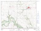
Maps showing Hill Sixty, 4-2-7-W, Manitoba
Hill Sixty is a Mountain located in 4-2-7-W, Manitoba and has an elevation of 406 meters.
- Latitude: 49° 5' 52'' North (decimal: 49.0977999)
- Longitude: 98° 20' 28'' West (decimal: -98.3411000)
- Topography Feature Category: Mountain
- Geographical Feature: Hill
- Canadian Province/Territory: Manitoba
- Elevation: 406 meters
- Location: 4-2-7-W
- Atlas of Canada Locator Map: Hill Sixty
- GPS Coordinate Locator Map: Hill Sixty Lat/Long