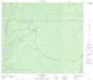
Maps showing Skunk Rapids, 17-67-11-W, Manitoba
Skunk Rapids is a Rapids located in 17-67-11-W, Manitoba and has an elevation of 239 meters.
- Latitude: 54° 47' 54'' North (decimal: 54.7983000)
- Longitude: 99° 5' 50'' West (decimal: -99.0972000)
- Topography Feature Category: Rapids
- Geographical Feature: Rapids
- Canadian Province/Territory: Manitoba
- Elevation: 239 meters
- Location: 17-67-11-W
- Atlas of Canada Locator Map: Skunk Rapids
- GPS Coordinate Locator Map: Skunk Rapids Lat/Long
Skunk Rapids NTS Map Sheets