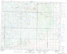
Maps showing (The) Sleeping Giants, Manitoba
(The) Sleeping Giants is a Mountain located in Manitoba.
- Latitude: 51° 16' 48'' North (decimal: 51.2800000)
- Longitude: 100° 47' 14'' West (decimal: -100.7871999)
- Topography Feature Category: Mountain
- Geographical Feature: Hills
- Canadian Province/Territory: Manitoba
- GPS Coordinate Locator Map: (The) Sleeping Giants Lat/Long
(The) Sleeping Giants NTS Map Sheets