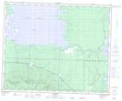
Maps showing Smith Point, 22-45-25-W, Manitoba
Smith Point is a Cape located in 22-45-25-W, Manitoba and has an elevation of 269 meters.
- Latitude: 52° 53' 27'' North (decimal: 52.8908000)
- Longitude: 101° 0' 16'' West (decimal: -101.0043999)
- Topography Feature Category: Cape
- Geographical Feature: Point
- Canadian Province/Territory: Manitoba
- Elevation: 269 meters
- Location: 22-45-25-W
- Atlas of Canada Locator Map: Smith Point
- GPS Coordinate Locator Map: Smith Point Lat/Long