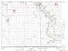
Maps showing Smiths Bridge, 34-1-9-W, Manitoba
Smiths Bridge is a Road feature located in 34-1-9-W, Manitoba and has an elevation of 373 meters.
- Latitude: 49° 4' 31'' North (decimal: 49.0753000)
- Longitude: 98° 35' 21'' West (decimal: -98.5891999)
- Topography Feature Category: Road feature
- Geographical Feature: Bridge
- Canadian Province/Territory: Manitoba
- Elevation: 373 meters
- Location: 34-1-9-W
- Atlas of Canada Locator Map: Smiths Bridge
- GPS Coordinate Locator Map: Smiths Bridge Lat/Long
Smiths Bridge NTS Map Sheets