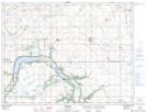
Maps showing Somerset Creek, 9-6-10-W, Manitoba
Somerset Creek is a River located in 9-6-10-W, Manitoba and has an elevation of 457 meters.
- Latitude: 49° 28' 10'' North (decimal: 49.4693999)
- Longitude: 98° 44' 56'' West (decimal: -98.7489000)
- Topography Feature Category: River
- Geographical Feature: Creek
- Canadian Province/Territory: Manitoba
- Elevation: 457 meters
- Location: 9-6-10-W
- Atlas of Canada Locator Map: Somerset Creek
- GPS Coordinate Locator Map: Somerset Creek Lat/Long