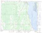
Maps showing South Island, 23-32-19-W, Manitoba
South Island is a Island located in 23-32-19-W, Manitoba.
- Latitude: 51° 46' North (decimal: 51.7666999)
- Longitude: 100° 3' West (decimal: -100.0499999)
- Topography Feature Category: Island
- Geographical Feature: Island
- Canadian Province/Territory: Manitoba
- Location: 23-32-19-W
- GPS Coordinate Locator Map: South Island Lat/Long
South Island NTS Map Sheets