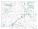
Maps showing Spring Creek, 11-9-18-W, Manitoba
Spring Creek is a River located in 11-9-18-W, Manitoba and has an elevation of 436 meters.
- Latitude: 49° 43' 43'' North (decimal: 49.7285999)
- Longitude: 99° 48' 20'' West (decimal: -99.8056000)
- Topography Feature Category: River
- Geographical Feature: Creek
- Canadian Province/Territory: Manitoba
- Elevation: 436 meters
- Location: 11-9-18-W
- Atlas of Canada Locator Map: Spring Creek
- GPS Coordinate Locator Map: Spring Creek Lat/Long