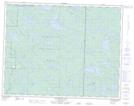
Maps showing Springer Lake, 18-15-E, Manitoba
Springer Lake is a Lake located in 18-15-E, Manitoba and has an elevation of 317 meters.
- Latitude: 50° 32' 1'' North (decimal: 50.5336000)
- Longitude: 95° 27' 12'' West (decimal: -95.4533000)
- Topography Feature Category: Lake
- Geographical Feature: Lake
- Canadian Province/Territory: Manitoba
- Elevation: 317 meters
- Location: 18-15-E
- Atlas of Canada Locator Map: Springer Lake
- GPS Coordinate Locator Map: Springer Lake Lat/Long
Springer Lake NTS Map Sheets