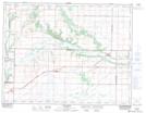
Maps showing Spring Valley Flats, 13,14,15-11-22-W, Manitoba
Spring Valley Flats is a Low vegetation located in 13,14,15-11-22-W, Manitoba and has an elevation of 363 meters.
- Latitude: 49° 55' 27'' North (decimal: 49.9242000)
- Longitude: 100° 23' 34'' West (decimal: -100.3928000)
- Topography Feature Category: Low vegetation
- Geographical Feature: Flats
- Canadian Province/Territory: Manitoba
- Elevation: 363 meters
- Location: 13,14,15-11-22-W
- Atlas of Canada Locator Map: Spring Valley Flats
- GPS Coordinate Locator Map: Spring Valley Flats Lat/Long