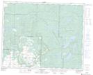
Maps showing Spruce Lake, 15-32-27-W, Manitoba
Spruce Lake is a Lake located in 15-32-27-W, Manitoba and has an elevation of 653 meters.
- Latitude: 51° 44' 45'' North (decimal: 51.7457999)
- Longitude: 101° 13' 4'' West (decimal: -101.2177999)
- Topography Feature Category: Lake
- Geographical Feature: Lake
- Canadian Province/Territory: Manitoba
- Elevation: 653 meters
- Location: 15-32-27-W
- Atlas of Canada Locator Map: Spruce Lake
- GPS Coordinate Locator Map: Spruce Lake Lat/Long
Spruce Lake NTS Map Sheets