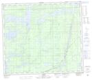
Maps showing Standing Stone Rapids, Manitoba
Standing Stone Rapids is a Rapids located in Manitoba and has an elevation of 183 meters.
- Latitude: 55° 45' 15'' North (decimal: 55.7541999)
- Longitude: 96° 58' 47'' West (decimal: -96.9796999)
- Topography Feature Category: Rapids
- Geographical Feature: Rapids
- Canadian Province/Territory: Manitoba
- Elevation: 183 meters
- Atlas of Canada Locator Map: Standing Stone Rapids
- GPS Coordinate Locator Map: Standing Stone Rapids Lat/Long