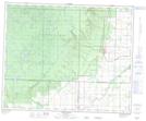
Maps showing Stanton Creek, 17-39-27-W, Manitoba
Stanton Creek is a River located in 17-39-27-W, Manitoba.
- Latitude: 52° 21' 37'' North (decimal: 52.3602999)
- Longitude: 101° 18' 29'' West (decimal: -101.3080999)
- Topography Feature Category: River
- Geographical Feature: Creek
- Canadian Province/Territory: Manitoba
- Location: 17-39-27-W
- Atlas of Canada Locator Map: Stanton Creek
- GPS Coordinate Locator Map: Stanton Creek Lat/Long
Stanton Creek NTS Map Sheets