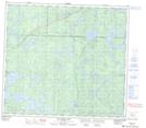
Maps showing Stear Lake, Manitoba
Stear Lake is a Lake located in Manitoba and has an elevation of 394 meters.
- Latitude: 56° 43' 14'' North (decimal: 56.7206000)
- Longitude: 101° 19' 37'' West (decimal: -101.3268999)
- Topography Feature Category: Lake
- Geographical Feature: Lake
- Canadian Province/Territory: Manitoba
- Elevation: 394 meters
- Atlas of Canada Locator Map: Stear Lake
- GPS Coordinate Locator Map: Stear Lake Lat/Long
Stear Lake NTS Map Sheets