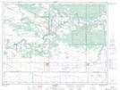
Maps showing Steels Ferry, 31-8-13-W, Manitoba
Steels Ferry is a Unincorporated area located in 31-8-13-W, Manitoba and has an elevation of 308 meters.
- Latitude: 49° 41' 45'' North (decimal: 49.6958000)
- Longitude: 99° 13' 54'' West (decimal: -99.2317000)
- Topography Feature Category: Unincorporated area
- Geographical Feature: Locality
- Canadian Province/Territory: Manitoba
- Elevation: 308 meters
- Location: 31-8-13-W
- Atlas of Canada Locator Map: Steels Ferry
- GPS Coordinate Locator Map: Steels Ferry Lat/Long