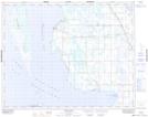
Maps showing Steep Rock Junction, 28-28-8-W, Manitoba
Steep Rock Junction is a Unincorporated area located in 28-28-8-W, Manitoba and has an elevation of 265 meters.
- Latitude: 51° 25' 45'' North (decimal: 51.4291999)
- Longitude: 98° 31' 39'' West (decimal: -98.5275000)
- Topography Feature Category: Unincorporated area
- Geographical Feature: Locality
- Canadian Province/Territory: Manitoba
- Elevation: 265 meters
- Location: 28-28-8-W
- Atlas of Canada Locator Map: Steep Rock Junction
- GPS Coordinate Locator Map: Steep Rock Junction Lat/Long
Steep Rock Junction NTS Map Sheets