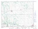
Maps showing Stephenfield Lake, 34,35,36-6-7-W, Manitoba
Stephenfield Lake is a Lake located in 34,35,36-6-7-W, Manitoba and has an elevation of 294 meters.
- Latitude: 49° 31' 35'' North (decimal: 49.5264000)
- Longitude: 98° 18' 14'' West (decimal: -98.3038999)
- Topography Feature Category: Lake
- Geographical Feature: Lake
- Canadian Province/Territory: Manitoba
- Elevation: 294 meters
- Location: 34,35,36-6-7-W
- Atlas of Canada Locator Map: Stephenfield Lake
- GPS Coordinate Locator Map: Stephenfield Lake Lat/Long