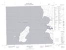
Maps showing Stevens Point, 39-2-E, Manitoba
Stevens Point is a Cape located in 39-2-E, Manitoba and has an elevation of 222 meters.
- Latitude: 52° 20' 4'' North (decimal: 52.3344000)
- Longitude: 97° 15' 11'' West (decimal: -97.2530999)
- Topography Feature Category: Cape
- Geographical Feature: Point
- Canadian Province/Territory: Manitoba
- Elevation: 222 meters
- Location: 39-2-E
- Atlas of Canada Locator Map: Stevens Point
- GPS Coordinate Locator Map: Stevens Point Lat/Long
Stevens Point NTS Map Sheets