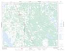
Maps showing Stewart Lake, 22-24-5-W, Manitoba
Stewart Lake is a Unincorporated area located in 22-24-5-W, Manitoba.
- Latitude: 51° 6' North (decimal: 51.0999999)
- Longitude: 98° 5' West (decimal: -98.0833000)
- Topography Feature Category: Unincorporated area
- Geographical Feature: Locality
- Canadian Province/Territory: Manitoba
- Location: 22-24-5-W
- GPS Coordinate Locator Map: Stewart Lake Lat/Long
Stewart Lake NTS Map Sheets