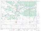
Maps showing Stockton Ferry, 28-7-15-W, Manitoba
Stockton Ferry is a Road feature located in 28-7-15-W, Manitoba and has an elevation of 335 meters.
- Latitude: 49° 36' 22'' North (decimal: 49.6061000)
- Longitude: 99° 26' 26'' West (decimal: -99.4406000)
- Topography Feature Category: Road feature
- Geographical Feature: Ferry
- Canadian Province/Territory: Manitoba
- Elevation: 335 meters
- Location: 28-7-15-W
- Atlas of Canada Locator Map: Stockton Ferry
- GPS Coordinate Locator Map: Stockton Ferry Lat/Long