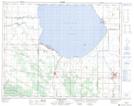
Maps showing Stony Point Beach, 26-17,18-W, Manitoba
Stony Point Beach is a Beach located in 26-17,18-W, Manitoba and has an elevation of 268 meters.
- Latitude: 51° 14' 58'' North (decimal: 51.2493999)
- Longitude: 99° 51' 5'' West (decimal: -99.8513999)
- Topography Feature Category: Beach
- Geographical Feature: Beach
- Canadian Province/Territory: Manitoba
- Elevation: 268 meters
- Location: 26-17,18-W
- Atlas of Canada Locator Map: Stony Point Beach
- GPS Coordinate Locator Map: Stony Point Beach Lat/Long
Stony Point Beach NTS Map Sheets