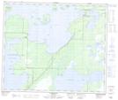
Maps showing Réserve indienne Stony Point 21, Manitoba
Réserve indienne Stony Point 21 is a Indian Reserve located in Manitoba.
- Latitude: 54° 2' 59'' North (decimal: 54.0496999)
- Longitude: 100° 56' 00'' West (decimal: -100.9333000)
- Topography Feature Category: Indian Reserve
- Geographical Feature: Réserve indienne
- Canadian Province/Territory: Manitoba
- GPS Coordinate Locator Map: Réserve indienne Stony Point 21 Lat/Long
Réserve indienne Stony Point 21 NTS Map Sheets