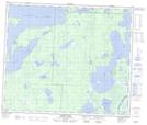
Maps showing Sturgeon Point, 60,61-29-W, Manitoba
Sturgeon Point is a Cape located in 60,61-29-W, Manitoba and has an elevation of 273 meters.
- Latitude: 54° 14' 45'' North (decimal: 54.2458000)
- Longitude: 101° 46' 49'' West (decimal: -101.7802999)
- Topography Feature Category: Cape
- Geographical Feature: Point
- Canadian Province/Territory: Manitoba
- Elevation: 273 meters
- Location: 60,61-29-W
- Atlas of Canada Locator Map: Sturgeon Point
- GPS Coordinate Locator Map: Sturgeon Point Lat/Long
Sturgeon Point NTS Map Sheets