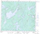
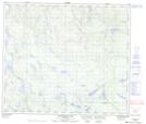
Maps showing Styne Lake, 25-69-19-W, Manitoba
Styne Lake is a Lake located in 25-69-19-W, Manitoba and has an elevation of 317 meters.
- Latitude: 54° 60' 00'' North (decimal: 54.9999999)
- Longitude: 100° 12' 30'' West (decimal: -100.2082999)
- Topography Feature Category: Lake
- Geographical Feature: Lake
- Canadian Province/Territory: Manitoba
- Elevation: 317 meters
- Location: 25-69-19-W
- Atlas of Canada Locator Map: Styne Lake
- GPS Coordinate Locator Map: Styne Lake Lat/Long
Styne Lake NTS Map Sheets