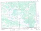
Maps showing Sundown Lake, 16,21,22-2-10-E, Manitoba
Sundown Lake is a Lake located in 16,21,22-2-10-E, Manitoba and has an elevation of 333 meters.
- Latitude: 49° 8' 7'' North (decimal: 49.1352999)
- Longitude: 96° 11' 46'' West (decimal: -96.1961000)
- Topography Feature Category: Lake
- Geographical Feature: Lake
- Canadian Province/Territory: Manitoba
- Elevation: 333 meters
- Location: 16,21,22-2-10-E
- Atlas of Canada Locator Map: Sundown Lake
- GPS Coordinate Locator Map: Sundown Lake Lat/Long