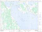
Maps showing Sveistrup Bay, Manitoba
Sveistrup Bay is a Bay located in Manitoba and has an elevation of 247 meters.
- Latitude: 50° 53' 30'' North (decimal: 50.8917000)
- Longitude: 98° 37' 19'' West (decimal: -98.6219000)
- Topography Feature Category: Bay
- Geographical Feature: Bay
- Canadian Province/Territory: Manitoba
- Elevation: 247 meters
- Atlas of Canada Locator Map: Sveistrup Bay
- GPS Coordinate Locator Map: Sveistrup Bay Lat/Long