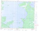
Maps showing Swamp Creek, 16-45-22-W, Manitoba
Swamp Creek is a River located in 16-45-22-W, Manitoba.
- Latitude: 52° 52' 21'' North (decimal: 52.8725000)
- Longitude: 100° 36' 15'' West (decimal: -100.6042000)
- Topography Feature Category: River
- Geographical Feature: Creek
- Canadian Province/Territory: Manitoba
- Location: 16-45-22-W
- Atlas of Canada Locator Map: Swamp Creek
- GPS Coordinate Locator Map: Swamp Creek Lat/Long
Swamp Creek NTS Map Sheets