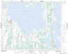
Maps showing Szewczuks Creek, 30-30-16-W, Manitoba
Szewczuks Creek is a River located in 30-30-16-W, Manitoba and has an elevation of 261 meters.
- Latitude: 51° 35' 56'' North (decimal: 51.5989000)
- Longitude: 99° 42' 11'' West (decimal: -99.7031000)
- Topography Feature Category: River
- Geographical Feature: Creek
- Canadian Province/Territory: Manitoba
- Elevation: 261 meters
- Location: 30-30-16-W
- Atlas of Canada Locator Map: Szewczuks Creek
- GPS Coordinate Locator Map: Szewczuks Creek Lat/Long
Szewczuks Creek NTS Map Sheets