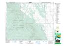
Maps showing Tea Creek, 17-20-17-W, Manitoba
Tea Creek is a River located in 17-20-17-W, Manitoba and has an elevation of 673 meters.
- Latitude: 50° 43' 34'' North (decimal: 50.7260999)
- Longitude: 99° 47' 36'' West (decimal: -99.7932999)
- Topography Feature Category: River
- Geographical Feature: Creek
- Canadian Province/Territory: Manitoba
- Elevation: 673 meters
- Location: 17-20-17-W
- Atlas of Canada Locator Map: Tea Creek
- GPS Coordinate Locator Map: Tea Creek Lat/Long
Tea Creek NTS Map Sheets