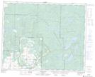
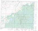
Maps showing Tee Lakes, 13,24-32-27-W, Manitoba
Tee Lakes is a Lake located in 13,24-32-27-W, Manitoba and has an elevation of 648 meters.
- Latitude: 51° 44' 50'' North (decimal: 51.7471999)
- Longitude: 101° 9' 45'' West (decimal: -101.1625000)
- Topography Feature Category: Lake
- Geographical Feature: Lakes
- Canadian Province/Territory: Manitoba
- Elevation: 648 meters
- Location: 13,24-32-27-W
- Atlas of Canada Locator Map: Tee Lakes
- GPS Coordinate Locator Map: Tee Lakes Lat/Long
Tee Lakes NTS Map Sheets