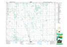
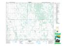
Maps showing Tenby, 36-17-13-W, Manitoba
Tenby is a Unincorporated area located in 36-17-13-W, Manitoba and has an elevation of 286 meters.
- Latitude: 50° 29' 59'' North (decimal: 50.4997000)
- Longitude: 99° 7' 39'' West (decimal: -99.1275000)
- Topography Feature Category: Unincorporated area
- Geographical Feature: Community
- Canadian Province/Territory: Manitoba
- Elevation: 286 meters
- Location: 36-17-13-W
- Atlas of Canada Locator Map: Tenby
- GPS Coordinate Locator Map: Tenby Lat/Long
Tenby NTS Map Sheets