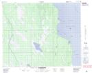
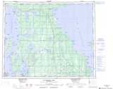
Maps showing The Big Bend, 13-35-7-W, Manitoba
The Big Bend is a River feature located in 13-35-7-W, Manitoba and has an elevation of 239 meters.
- Latitude: 52° 0' 20'' North (decimal: 52.0056000)
- Longitude: 98° 20' 22'' West (decimal: -98.3393999)
- Topography Feature Category: River feature
- Geographical Feature: Bend
- Canadian Province/Territory: Manitoba
- Elevation: 239 meters
- Location: 13-35-7-W
- Atlas of Canada Locator Map: The Big Bend
- GPS Coordinate Locator Map: The Big Bend Lat/Long
The Big Bend NTS Map Sheets