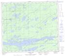
Maps showing Thompson Junction, 33-74-1-E, Manitoba
Thompson Junction is a Unincorporated area located in 33-74-1-E, Manitoba and has an elevation of 194 meters.
- Latitude: 55° 27' 35'' North (decimal: 55.4596999)
- Longitude: 97° 23' 54'' West (decimal: -97.3983000)
- Topography Feature Category: Unincorporated area
- Geographical Feature: Railway Point
- Canadian Province/Territory: Manitoba
- Elevation: 194 meters
- Location: 33-74-1-E
- Atlas of Canada Locator Map: Thompson Junction
- GPS Coordinate Locator Map: Thompson Junction Lat/Long
Thompson Junction NTS Map Sheets