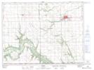
Maps showing Thornhill, 8-3-6-W, Manitoba
Thornhill is a Unincorporated area located in 8-3-6-W, Manitoba and has an elevation of 391 meters.
- Latitude: 49° 12' 1'' North (decimal: 49.2002999)
- Longitude: 98° 13' 54'' West (decimal: -98.2316999)
- Topography Feature Category: Unincorporated area
- Geographical Feature: Community
- Canadian Province/Territory: Manitoba
- Elevation: 391 meters
- Location: 8-3-6-W
- Atlas of Canada Locator Map: Thornhill
- GPS Coordinate Locator Map: Thornhill Lat/Long