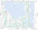
Maps showing Thorsteinson Creek, 4-32-18-W, Manitoba
Thorsteinson Creek is a River located in 4-32-18-W, Manitoba and has an elevation of 269 meters.
- Latitude: 51° 43' 4'' North (decimal: 51.7177779)
- Longitude: 99° 57' 3'' West (decimal: -99.9508328)
- Topography Feature Category: River
- Geographical Feature: Creek
- Canadian Province/Territory: Manitoba
- Elevation: 269 meters
- Location: 4-32-18-W
- Atlas of Canada Locator Map: Thorsteinson Creek
- GPS Coordinate Locator Map: Thorsteinson Creek Lat/Long
Thorsteinson Creek NTS Map Sheets