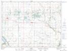
Maps showing Thorsteinsons Lake, 34-5-14-W, Manitoba
Thorsteinsons Lake is a Lake located in 34-5-14-W, Manitoba and has an elevation of 414 meters.
- Latitude: 49° 26' 13'' North (decimal: 49.4369000)
- Longitude: 99° 16' 59'' West (decimal: -99.2831000)
- Topography Feature Category: Lake
- Geographical Feature: Lake
- Canadian Province/Territory: Manitoba
- Elevation: 414 meters
- Location: 34-5-14-W
- Atlas of Canada Locator Map: Thorsteinsons Lake
- GPS Coordinate Locator Map: Thorsteinsons Lake Lat/Long