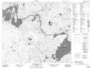
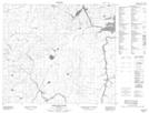
Maps showing Threepoint Lake, 77,78-10,11-W, Manitoba
Threepoint Lake is a Lake located in 77,78-10,11-W, Manitoba and has an elevation of 234 meters.
- Latitude: 55° 41' 2'' North (decimal: 55.6838999)
- Longitude: 98° 55' 14'' West (decimal: -98.9206000)
- Topography Feature Category: Lake
- Geographical Feature: Lake
- Canadian Province/Territory: Manitoba
- Elevation: 234 meters
- Location: 77,78-10,11-W
- Atlas of Canada Locator Map: Threepoint Lake
- GPS Coordinate Locator Map: Threepoint Lake Lat/Long
Threepoint Lake NTS Map Sheets