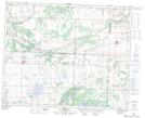
Maps showing Thunder Hill, 10-35-29-W, Manitoba
Thunder Hill is a Unincorporated area located in 10-35-29-W, Manitoba and has an elevation of 395 meters.
- Latitude: 51° 59' 50'' North (decimal: 51.9971999)
- Longitude: 101° 31' 19'' West (decimal: -101.5218999)
- Topography Feature Category: Unincorporated area
- Geographical Feature: Locality
- Canadian Province/Territory: Manitoba
- Elevation: 395 meters
- Location: 10-35-29-W
- Atlas of Canada Locator Map: Thunder Hill
- GPS Coordinate Locator Map: Thunder Hill Lat/Long
Thunder Hill NTS Map Sheets