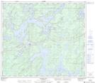
Maps showing Timew Narrows, 21-80-12-W, Manitoba
Timew Narrows is a Channel located in 21-80-12-W, Manitoba and has an elevation of 273 meters.
- Latitude: 55° 56' 53'' North (decimal: 55.9481000)
- Longitude: 99° 16' 44'' West (decimal: -99.2789000)
- Topography Feature Category: Channel
- Geographical Feature: Narrows
- Canadian Province/Territory: Manitoba
- Elevation: 273 meters
- Location: 21-80-12-W
- Atlas of Canada Locator Map: Timew Narrows
- GPS Coordinate Locator Map: Timew Narrows Lat/Long
Timew Narrows NTS Map Sheets