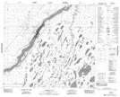
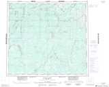
Maps showing Tiny Creek, 88-1-E, Manitoba
Tiny Creek is a River located in 88-1-E, Manitoba and has an elevation of 101 meters.
- Latitude: 56° 38' 11'' North (decimal: 56.6364000)
- Longitude: 93° 51' 19'' West (decimal: -93.8552999)
- Topography Feature Category: River
- Geographical Feature: Creek
- Canadian Province/Territory: Manitoba
- Elevation: 101 meters
- Location: 88-1-E
- Atlas of Canada Locator Map: Tiny Creek
- GPS Coordinate Locator Map: Tiny Creek Lat/Long
Tiny Creek NTS Map Sheets