Canada Topographic Maps

Touchwood Lake Topo Maps

Topography maps and Latitude/Longitude Location

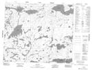
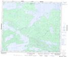
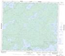
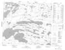
Maps showing Touchwood Lake, Manitoba

Touchwood Lake is a Lake located in Manitoba and has an elevation of 186 meters.

  • Latitude: 54° 28' 45'' North   (decimal: 54.4792000)
  • Longitude: 94° 59' 46'' West   (decimal: -94.9960999)
  • Topography Feature Category: Lake
  • Geographical Feature: Lake
  • Canadian Province/Territory: Manitoba
  • Elevation: 186 meters
  • Atlas of Canada Locator Map: Touchwood Lake
  • GPS Coordinate Locator Map: Touchwood Lake Lat/Long

Touchwood Lake NTS Map Sheets

053L06 Joint Lake Topographic Map at 1:50,000 scale

053L07 Kanuchuan Rapids Topographic Map at 1:50,000 scale

053L10 Vermilyea Lake Topographic Map at 1:50,000 scale

053L11 Munro Lake Topographic Map at 1:50,000 scale

053L Oxford House Topographic Map at 1:250,000 scale

 
Buy Topographic Maps DVD
Newsletter Sign-up

Yes, I want to receive map store discounts.


Bookmark and Share