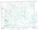
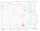
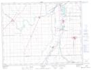
Maps showing Tourond Creek, 10-8-3-E, Manitoba
Tourond Creek is a River located in 10-8-3-E, Manitoba and has an elevation of 252 meters.
- Latitude: 49° 38' 19'' North (decimal: 49.6385999)
- Longitude: 97° 6' 40'' West (decimal: -97.1110999)
- Topography Feature Category: River
- Geographical Feature: Creek
- Canadian Province/Territory: Manitoba
- Elevation: 252 meters
- Location: 10-8-3-E
- Atlas of Canada Locator Map: Tourond Creek
- GPS Coordinate Locator Map: Tourond Creek Lat/Long
Tourond Creek NTS Map Sheets