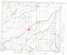
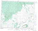
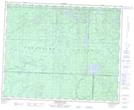
Maps showing Trout Creek, 7-37-28-W, Manitoba
Trout Creek is a River located in 7-37-28-W, Manitoba and has an elevation of 380 meters.
- Latitude: 52° 10' 21'' North (decimal: 52.1725000)
- Longitude: 101° 26' 53'' West (decimal: -101.4480999)
- Topography Feature Category: River
- Geographical Feature: Creek
- Canadian Province/Territory: Manitoba
- Elevation: 380 meters
- Location: 7-37-28-W
- Atlas of Canada Locator Map: Trout Creek
- GPS Coordinate Locator Map: Trout Creek Lat/Long
Trout Creek NTS Map Sheets