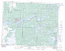
Maps showing Twin Falls, 18-13-15-E, Manitoba
Twin Falls is a Falls located in 18-13-15-E, Manitoba and has an elevation of 304 meters.
- Latitude: 50° 4' 43'' North (decimal: 50.0786000)
- Longitude: 95° 32' 6'' West (decimal: -95.5349999)
- Topography Feature Category: Falls
- Geographical Feature: Falls
- Canadian Province/Territory: Manitoba
- Elevation: 304 meters
- Location: 18-13-15-E
- Atlas of Canada Locator Map: Twin Falls
- GPS Coordinate Locator Map: Twin Falls Lat/Long
Twin Falls NTS Map Sheets