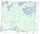
Maps showing Two Mile Rapids, 22-62-29-W, Manitoba
Two Mile Rapids is a Rapids located in 22-62-29-W, Manitoba and has an elevation of 276 meters.
- Latitude: 54° 22' 44'' North (decimal: 54.3788999)
- Longitude: 101° 42' 18'' West (decimal: -101.7050000)
- Topography Feature Category: Rapids
- Geographical Feature: Rapids
- Canadian Province/Territory: Manitoba
- Elevation: 276 meters
- Location: 22-62-29-W
- Atlas of Canada Locator Map: Two Mile Rapids
- GPS Coordinate Locator Map: Two Mile Rapids Lat/Long
Two Mile Rapids NTS Map Sheets