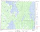
Maps showing Upper Salt Creek, 24-43-21-W, Manitoba
Upper Salt Creek is a River located in 24-43-21-W, Manitoba and has an elevation of 273 meters.
- Latitude: 52° 42' 54'' North (decimal: 52.7149999)
- Longitude: 100° 22' 53'' West (decimal: -100.3813999)
- Topography Feature Category: River
- Geographical Feature: Creek
- Canadian Province/Territory: Manitoba
- Elevation: 273 meters
- Location: 24-43-21-W
- Atlas of Canada Locator Map: Upper Salt Creek
- GPS Coordinate Locator Map: Upper Salt Creek Lat/Long
Upper Salt Creek NTS Map Sheets