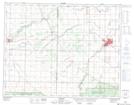
Maps showing Valley River, 13-26-20-W, Manitoba
Valley River is a Unincorporated area located in 13-26-20-W, Manitoba and has an elevation of 291 meters.
- Latitude: 51° 14' 53'' North (decimal: 51.2480999)
- Longitude: 100° 8' 35'' West (decimal: -100.1430999)
- Topography Feature Category: Unincorporated area
- Geographical Feature: Community
- Canadian Province/Territory: Manitoba
- Elevation: 291 meters
- Location: 13-26-20-W
- Atlas of Canada Locator Map: Valley River
- GPS Coordinate Locator Map: Valley River Lat/Long
Valley River NTS Map Sheets